Thursday, May 31, 2012

Day 25 from Nehalem Bay to Cape Mears


It was another day of being a herd of turtles.  Since I came in so late, I wasn't able to set the bike up the night before, so I ended up spending much of the morning setting up the bike again.  The red-headed family in the next campsite over (mom, dad & 4 kids) were nearly completely packed up and ready to go by the time that we managed to head out.

Riding out from the campsite, I headed off towards Nehalem, and in search of a natural foods store, as I needed to get more nuts and dried fruit for my "trail mix"a.k.a. bonk preventer.  Unfortunately, the store that I was thinking of wasn't in Nehalem, it was in Manzanita, the previous town on 101, which I managed to avoid entirely.  By the time that I realized that, it was way too late for me to want to backtrack, so I headed onward assuming that I'd be able to find something in Tillamook.

Just after passing through Nehalem, I saw the sign for the Nehalem Bay Winery:
Nehalem Bay Winery sign
I thought that it might be interesting, but I wanted to make it all the way into Cape Mears, so didn't want to take the left turn into Mears.  Sharon did, however, and picked up a bottle of Pinot at the winery.

The next wide spot in the road was Garabaldi, where I decided that I had to stop to take a picture of the rolling stock that I saw just sitting on the tracks by the side of the road:
It's not everyday that you see this just sitting there...
Garabaldi also had an impressive (to me at least) view:
From the road in Garabaldi
Sharon and I met up in Rockaway Beach, where we were planning to go to Woody's (they're supposed to have a great pulled pork sandwich), but they were closed.  Since we were quite hungry, we went to Grumpy’s:
Grumpy's
Grumpy's is a family operation (Dad runs the kitchen, daughter works the front of the house), and they say that they work hard to keep the prices low so that locals have a place that they can go.  The food was pretty good and their prices are also quite good.  They also have an attitude that says that they're a local joint, as daughter was playfully teasing the male of the older couple that was sitting behind us - "but you didn't eat your vegetables.  And I remember that you didn't eat your vegetables last time either.  I should just keep these and add them to your plate the next time you come in..."  Needless to say, I liked the place.

When we finished there, I headed out towards Tillamook.  It was late enough that I wasn't able to visit the Tillamook Country smokehouse or the cheese factory.  In fact, by the time I pulled into Tillamook, I was pretty desperate for a bathroom, and pulled into the first place that I knew would have one - the Fred Myers.  After leaving the bathroom, I found that I was already at the "nuts and snacks" aisle, and found that I was able to get at least almonds, cashews and dried cranberries for my trail mix.  No dried blueberries this time around, but that would probably be asking for too much.

From there, I just took the turn to the three capes scenic route.  The ride out to Cape mears was really flat and pretty nice, but the headwind was fierce.  As I passed Bayocean spit, I stopped and read the sign describing the short-lived community of Bayocean park (I failed to photograph it though, which is too bad, because the story is rather interesting).

Finally I reached my destination in Cape Mears.  Wonder of wonders, I was able to take a hot shower and get comfortable.  Sharon was starting laundry, so I took all of my dirty clothes out to add them to the load.  However, this left me with only a hawaiian shirt and a sarong to wear for the evening:
It's not every day that I wear a Sarong (incorrectly)
We had a very nice dinner of salad with home grown lettuce and grilled pork tenderloin and had the bottle of wine that Sharon bought.  After she went off to bed, I stayed up with my friend. We consumed another bottle of wine and continued talking - it eventually became very drunk out, and I finally went to bed about 4 AM.

Ride: about 41 miles - no stats, because that phone had to get a hard reset, but more about that in the next episode.

Wednesday, May 30, 2012

Day 24 - From Fort Stevens State Park to Nehalem Bay state park


Day 24 (May 28th)
Here's a picture of our campsite in the morning
Our campsite

The tarp over the camper succeeded in keeping Sharon dry - another problem worked around.  While setting up for the ride I ended up in a fairly long conversation with a couple of the kids from neighboring campsites.  They were really interested in the bike and how it works.  The fairing, especially got a lot of interest.

After heading out of camp, I made my way to 101 south, and pedaled my way down to Seaside.  Sharon and I met at the beach on the north end of the promenade, where we had a couple of fun signs:
Fun Sign #1
Fun Sign #2
I headed down the promenade, where I ran into a father and daughter team who are riding part of the Lewis and Clark trail (I think) - they're keeping track of it on Crazy Guy on a Bike, but I haven't found their trip reports yet.
The father/daughter team on the Lewis & Clark trail
I also got to stop and talk to a few people about the bike and the trip.  It's fun when that happens.

I went back to 101 and over a decent sized hill.  At the top of the hill was a historical marker:
Historical marker on 101
From here, I cruised downhill and picked up some good speed right before heading off of 101 and into Cannon Beach.  On the way into Cannon beach, there were a couple of fun places,including this kite shop:
Kite shop on the way into Cannon Beach
 And then I passed this "sculpture"


This caught my eye too

The views in Cannon Beach are truly spectacular:

Viewed from the road in Cannon Beach
From the same place aiming West instead of South
I headed back out of Cannon beach on 101 aiming south.  When I saw this sign, I laughed:
Seems like a good idea to me

Then on 101 there was this tunnel: 
The Tunnel
for some reason I really don't like the idea of riding through a tunnel, so I took a break to examine my maps - somewhere around here there's supposed to be a campground at Oswald West State park, but I couldn't tell from the map which side of the tunnel the entrance was on.  The spot that I chose to wait was pretty picturesque in and of itself:

This was the end of the pavement
So I decided to go through the tunnel and check out the next couple of miles to see if I could find this campsite.  On the other side of the tunnel, I went straight up a hill for a mile or two.  According to my map, it's about 500 feet high.  But then I see signs for the state park - at least I'm in the right place.  Coming down the other side of the hill, I see a big parking lot for beach access, then just starting uphill again, there's another parking lot.  I get over there and ... there's no campsite anymore!  They've closed it.  At this point, I am looking at another 600 feet of climb, twilight is approaching and I'm pretty pooped.  So I call in the cavalry, and Sharon comes and picks me up.  We load the bike into the truck and drive about 8 miles to Nehalem Bay state park, where we camp next to a very nice family (who have 4 kids age 2-8).  It's pretty late when we arrive, so the kids aren't a problem - they just went to sleep not long after we arrived.
We cooked up dinner of grilled salmon, which we ate with a baguette, and contemplated the crab that we had on ice - then we decided that crab would make a fine breakfast, packed in the vermin attractors and went to bed.


Distance: about 35 miles riding - due to technical problems, exact info was not recorded.

Day 23 - County line park to Fort Stevens State park

Day 23 (27th)

After Breakfast, while setting up the bike for a ride, I had a conversation with one of our neighbors at the campsite - about the bike and ride, as well as his red Husky (a fine looking dog), and the seven pound steelhead that he just caught.  A decent way to start the day.

Riding out from the campsite, it was another several miles on the road stapled to the side of the bluff, then at Cathlamet, I turned left and rode to Puget island, where Sharon and I caught the ferry from Puget Island to Westport, OR.  This is reputed to be the last ferry plying the lower Columbia river.

On the ferry
The Westport ferry dock
As you can see from the pictures, this is a small operation.  The ferry runs once an hour on the hour (heading south), and is definitely a nice alternative to the Astoria bridge.

Leaving Westport, I started uphill nearly immediately, and it continued to be fairly steep for a while.  By the time I reached the top, it seemed like I could feel every one of the 656 feet of elevation:
The summit of that long hill
Sharon and I met at Knappa, OR and ate at the Red Heron.  I had a cup of good coffee, and a good sandwich.  They also have Tillamook ice cream and a tanning bed (??).  Apparently the tanning bed predates the coffee shop.
The Red Heron
Setting off, I headed towards Astoria, while Sharon ran ahead to Fort Stevens state park to try to secure a campsite.

I finally reach Astoria, somewhat pooped and in need of water and a bathroom.  Stopping in at a Chevron station, I used the facilities and bought  bottle of water.  The clerk complimented my bike, and we started talking.  It turns out that he has a friend who just summited Mt. Everest.

Riding out, I passed under the Astoria bridge:
The Astoria Bridge
I then headed out across another bridge to Warenton.  Riding through Warrenton, I saw the following thrift store:
Do they know the rest of that saying?
This makes me wonder: does anyone know the sayings that they quote on their signs?

Finally, I roll into Fort Stevens state park.  Sharon has managed to secure a campsite from someone who wasn't going to be able to use it that night.  This was a good thing, since the whole, huge campground was full unto bursting.  The campsite was expensive, but has free hot showers and nice sites (albeit a lot of them).  
I decided that I could do without the kids riding Big Wheels down the hill, but they’re less annoying than their parents getting drunk and carousing until 2:30 AM.


Statistics:
Distance: 51.1 miles - my first half-century!
Average speed: 7.4 mph
Top speed: ~38 mph
3200 feet ascent, 3260 feet descent

My legs are a bit sore...

Day 22– Leaving Portland and starting to ride again (May 26th)


Sharon and I finally get everything together and get out of Portland sometime in the early afternoon on Saturday.  We then head back north on I-5 to Kelso, and Sharon visited the Kelso historical society museum while I reassembled the bike and reorganized the camper so that it was again useable.

Once the bike was back together in functional order, we headed off.  Kelso is awfully spread out for a town of its population, and it seemed like it took forever to get out of town (heading west on WA 4).  The bike route in Kelso is actually on the sidewalks, so a couple of times I had to get the attention of a group of teenaged males, so that I could pass by them.  Each time, I heard one of them say “that is a really cool bike” – I appreciated that.

Once I finally got out of Kelso, I saw this sign:
Makes me think of Jeanne
the sign made me think of Jeanne, because she used to live in Long Beach, WA.  In fact, her beloved Woof, Gussie, is buried in the dunes there.  I remember Gussie – she was such a sweet animal.  Ah well, I digress, and besides I make myself sniffle and tear up…so back to the ride.

Much of the ride was right next to the Columbia river, which provided some fun viewing – the river scenes themselves are attractive, but sometimes other things caugh my attention or amused me along the way, for example – the tower (in the river) which had been taken over by eagles (I think). 
The tower that's been taken over by eagles
The nest was quite impressive
The Nest
I rode through “historic” Stella
on a road which was often carved out of the bluff
The road was carved out of the bluff
Because of the late start, I didn’t get very far.  We ended up camping in county line park, our least expnsive campsite, which appears to mainly be a fishing camp.  We got one of the last sites (an RV site).  
Actually, for tent camping, I would actually stay there again, squeezed between the road and the water.


Statistics:
Distance: 16.6 miles
Average Speed: 6.9 mph
Top speed: 33.6 mph

Day 21 - In Portland


We are staying with Tanya and family today.  It’s awfully nice to see Tanya again.  I think that she is one of the most sensible people that I know.  Even keeled and capable of dealing with a whole lot of things that other people couldn’t deal with.

We spent the day largely relaxing and catching up on various things.  I wrote a couple of blog entries and Sharon did the laundry and examined the wiring of the heritage building that Tanya lives in.

For dinner, Tanya made some pasta with a really tasty sauce, and I sautéed some mussels that Sharon got while we were in Toledo.  All in all a nice meal and good company.

If Sharon had been able to sleep better, and if Bird had gotten along with their Lab and/or their cat, it would have been perfect.  I am becoming convinced that bird is rather a bit of a brat and Sharon recognizes that Bird really needs to be socialized more.

Friday, May 25, 2012

Day 20 - Mount St. Helens and off to Portland

This morning we woke up early (about 6) when Sharon got too wet from the leak to stay asleep anymore. We made coffee, then I went to make omeletes for us for breakfast, and discovered that some of the eggs had frozen solid in the fridge - whoops, I guess that the eggs aren't going on the bottom of the fridge anymore.

Once I thawed the eggs, I made asparagus and mushroom omelets, then we packed up the camper to head back up to the mountain.

This time, we decided to stop at all of the little waypoints on the way up that were open (many weren't).  First we stopped at the buried A-frame:
The house was less than a week from being occupied when the mudflow hit
From the side
 Unfortunately, someone also decided to create this to try to increase tourist traffic:
Why?
About 17 miles from the Johnson observatory, you see this sign:
Beyond this point was the tree kill zone - between the blast and the heat from the pyroclastic flow, all the trees beyond this point were killed.  Because this area was managed by Weyerhauser lumber, they then planted a monoculture of noble fir, which (because of the time of year) produces a very strange looking striated forest:
The striated forest
To me, this looked like a very straight Moire pattern or some other computer graphics artifact.

The sign is at the edge of this bridge, which is pretty impressive in and of itself:
The Hoffstadt creek bridge
A little further up the road, Sharon and I stopped in at one of the visitor centers / outlook points:
Sharon and Bird in front of the river of volcanic mud
The gift shop there actually had a sale going on, and Sharon picked up a couple of pieces of fleecy clothing, and I picked up a new floppy hat, since I managed to lose my other one somewhere.

As we traveled further up the road, there were some really impressive scenes.  I think the part that impressed me the most was just the logs which were exposed by later subsequent erosion sticking out from the walls of volcanic mud:


Near the Johnson observatory, you can see the effects of the full blowdown:
All the trees were blown down by the blast


They just snapped off
Finally we got up to the Observatory -  we still can't view the lava dome through the fog, but the sights were fun nonetheless, and the observatory has a couple of really neat interactive displays and some good programs.
Sharon in her raingear at the observatory

Me at the Observatory with my new floppy hat
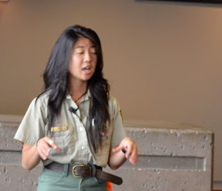
Gratuitous Ranger pic

On the way back down the mountain, after we crossed the bridge shown above, we saw this sign.


 In Kid's Valley, we decided to eat at Patty's place, which was actually quite good, and not too expensive, considering how little there is from here up to the observatory.
Good food, and not ridiculous prices
We then headed south to Portland to visit my friend Tanya and her family for a day before we head back north into Washington, and I get back on my bike to aim for Astoria and turn south down the coast.

Day 19 - To Toledo, WA and Mt. St. Helens

We woke up really late this morning - after 9 AM.  It was still raining.  After a breakfast of oatmeal, bananas and strawberries, we started packing up the camper.  Because of the rain, it took much longer than usual to pack up - as everything was wet and covered with fir needles.
Our Campsite at Lewis & Clark state park
Bird managed to get her teeth into something that didn't agree with her, so we also got to wash her soiled feathers.

We finally got moving sometime in the afternoon and dove to Toledo, "The Gateway to Mount Saint Helens".  From Toledo, we headed up to mount St. Helens.  The drive up was interesting, but the rain kept moving in and out.  During a break in the rain, we stopped at the Sediment retention area, where they're trying to slow the progress of the now very slow avalanche of debris from the eruptions.
That's a very tall mound of slow moving ash & volcanic debris
At the Elevation 3800 foot sign, there was snow by the side of the road.  The fog was also thick enough that one often couldn't see past the road
The fog took over
Every once in a while, the mountains would peek through - delivering an occasional awe inspiring sight:
The fog lifts a little to let us see this
By the time we got up to the Johnson Observatory, the rain had become constant again and there was no view to be had.  So we decided to come back the next day and headed back to Toledo to camp in their very nice city park.  The park has camping, a really large outdoor kitchen and a covered picnic area.  They also have hot showers!  I never would have thought that I would be so excited by showers.

Bird was still not having problems so Sharon went off to use the hot water to wash her hind end.  I then remembered that I'm carrying imodium, so we dosed Bird.

We went to bed fairly early, planning to get an early start to go back up the mountain and maybe see something more this time.

Day 18 - meandering through WA in the truck

After "The day the rain got me," we took a bit of a day off.  After I spent a few hours futzing with the phone that has now survived drowning twice, I repacked the camper with the folded bike inside and we headed off again very late from the Parkhurst motel.

As I said before, it's an interesting old style motel, with more room than you'd ever see in a modern motel room, although it probably hasn't been redecorated in 50 years:
The Parkhurst Motel
The owner says that they're refurbishing and rebuilding units, and that they're aiming to keep its historical nature intact - I hope that they succeed.  It's a neat place.


We then headed off to The Rusty Tractor, which is in fact surrounded by rusty tractors and other old farm implements:
Rusty Tractors at the Rusty Tractor
More Rusty Tractors

After we ate, we drove to Centralia, where we explored a few antique shops and purchased a couple of things for the camper.  When everything in Centralia closed down (about 5PM), we headed to Lewis and Clark state park, where we picked out a campsite and set up in the rain.  Because the bike was in a disassembled state, I put it in my tent for the night so that it wouldn't get soaked.  I dunno why I worried, given the rains that I've ridden through, but the tent was also useful to throw other stuff in to keep it clean and dry.

Sharon and I then proceeded to have dinner of clam chowder and turkey sandwiches, and set about to build a fire in the rain.  We managed to smoke ourselves pretty thoroughly, which did keep the mosquitos away.  We also discovered that my aluminum plates make a fine fan for the fire,and each of us spent a fair amount of time playing with the campfire - Sharon got it to finally take well, and then I worked on seeing if I could get it hot enough to destroy any of the aluminum cans that the previous users of the campsite left in the fire ring.  After a late evening playing with fire it was time for bed - where we discovered that the camper is leaking, especially around Sharon's bed.  Oh well, we'll have to figure out something.